A research blog about Warrington's New Town history
Warrington New Town Development Corporation archive: Early days
This section displays some of the photographs and slides that Local Archive at Chester have scanned for the Days of the New Town project. Unless otherwise stated, the images come from the Warrington New Town Development Corporation archive. Where possible, I have given the archive’s filing code for the image (a number prefigured by the initials NTW), in the hope that anyone who wishes to visit and use the archive themselves will have some reference points. Birchwood was one of five areas which the Development Corporation sought to develop. It is approximately five miles north east of Warrington town centre and it was the site of a huge ordnance factory during World War Two. The site took up all of what would become Oakwood, and some parts of Gorse Covert. I have heard on an anecdotal level that after the war it became the biggest single derelict site in Europe. Below (within NTW 68) is an image of part of the ordnance factory complex.
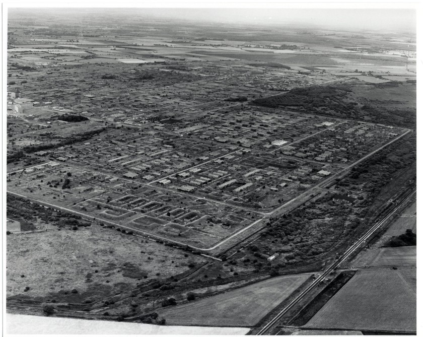
Above: a page from Robert Tregay and Roland Gustavsson’s Oakwood’s New Landscape: Designing for nature in a residential environment (NTW 68/19. Published jointly by WNTDC and Sveriges Lantbruksuniversitet 1983). Tregay was part of the landscape architects team at the Development Corporation which was led by David Scott. Here we see an aerial view prior to the ordnance factory being cleared. To give those familiar with Birchwood a sense of the scale of the site visible here: you are looking at the areas that would become Oakwood, Gorse Covert and Birchwood Forest Park. To the bottom right of the picture is the Liverpool to Manchester railway line. The darker vegetation visible towards the upper right of the picture is the moss that was preserved and opened as a nature reserve, Risley Moss in 1980.
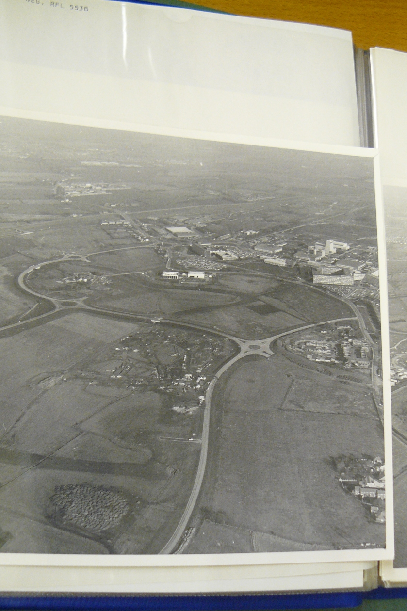
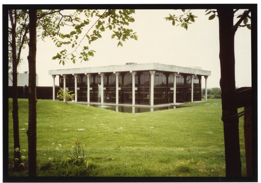
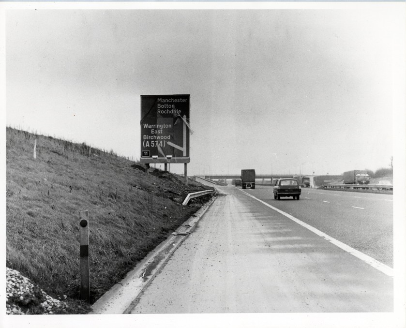
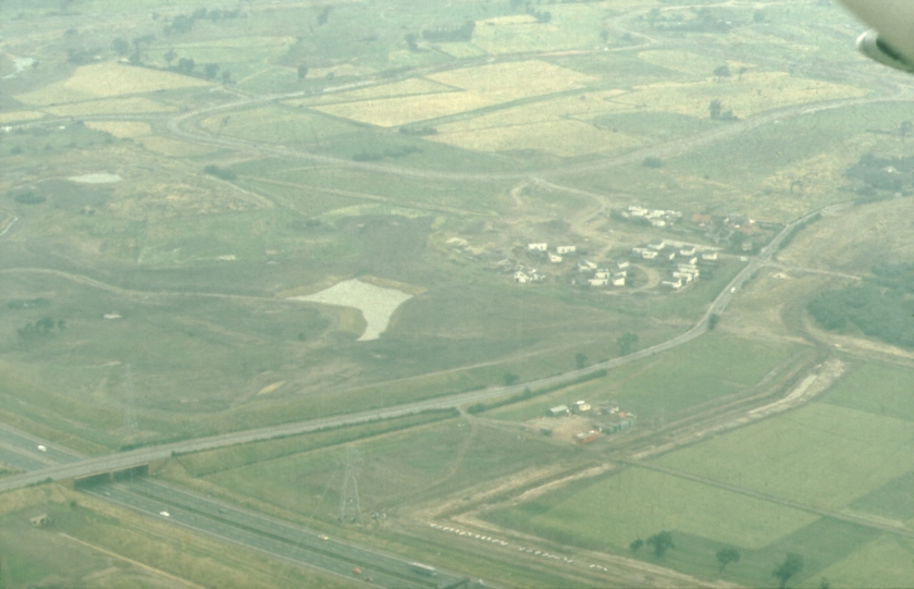
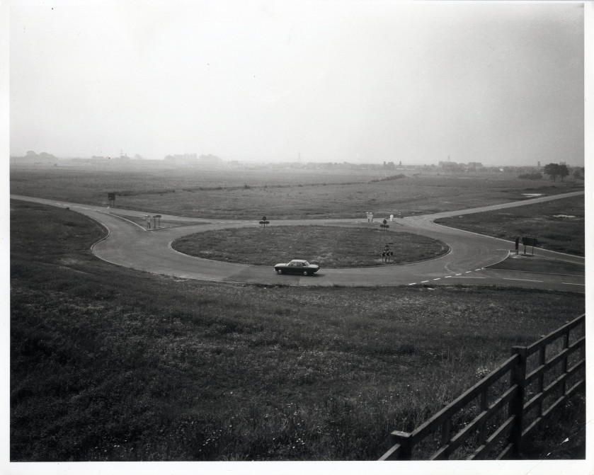
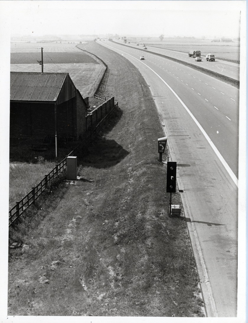
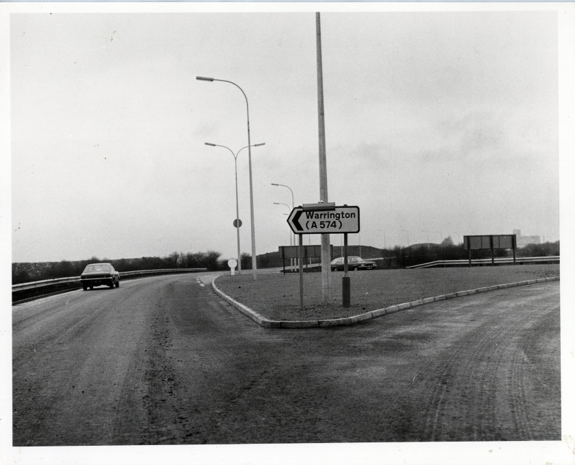
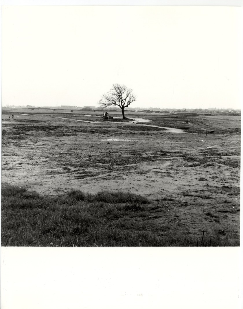
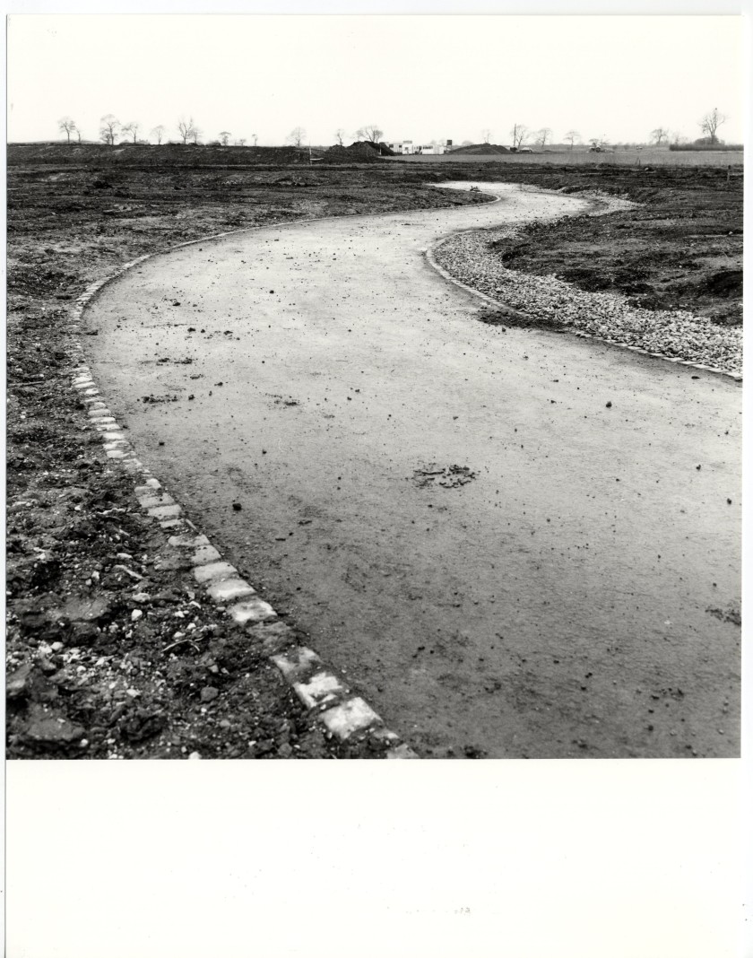
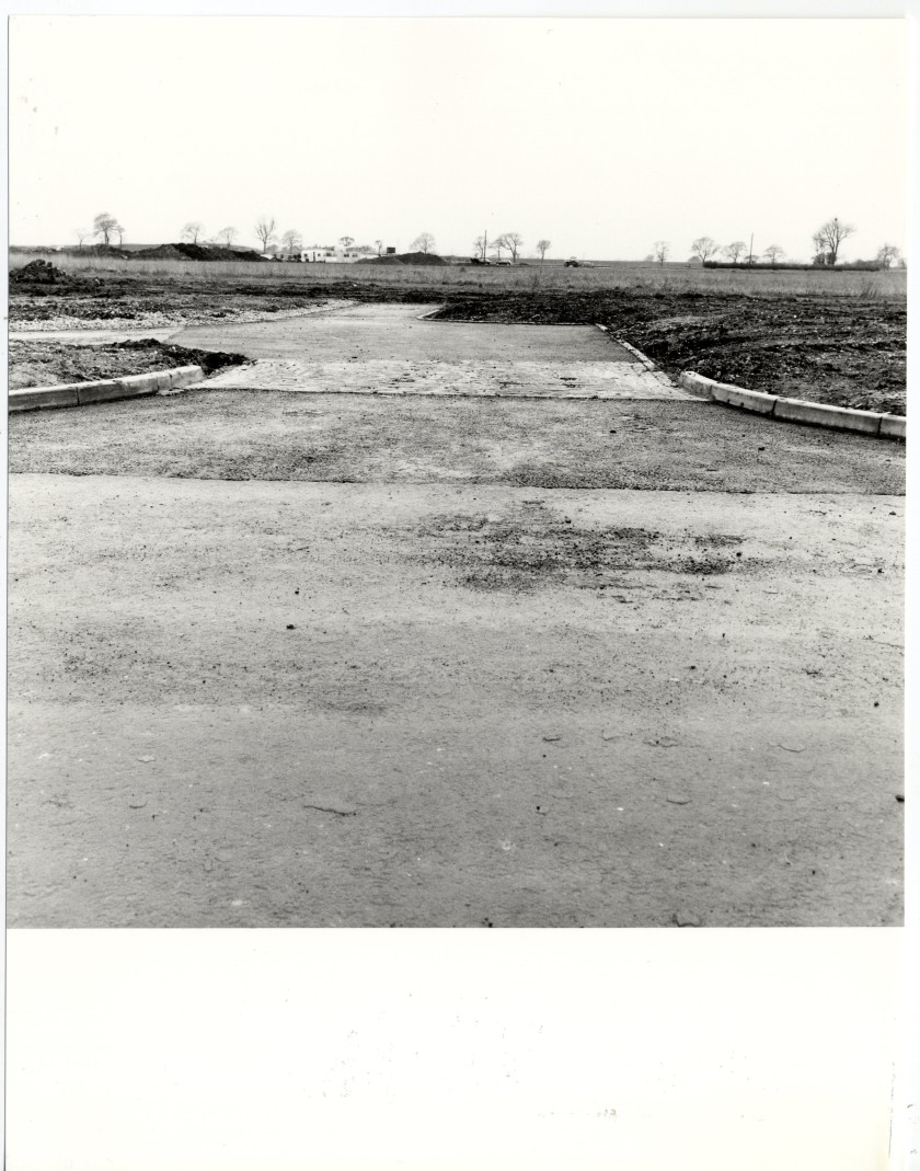
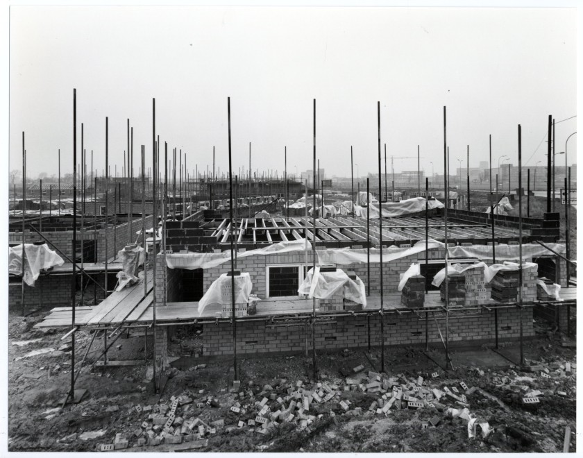
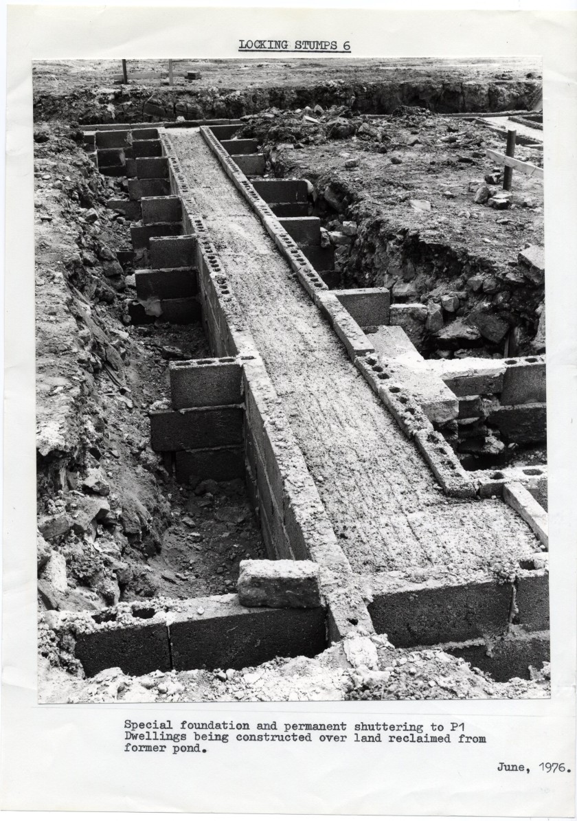
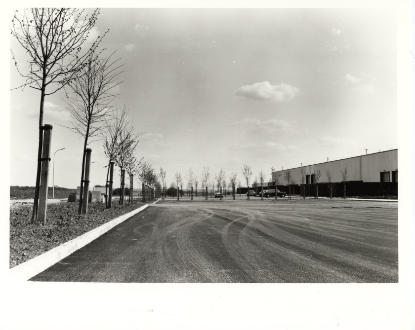
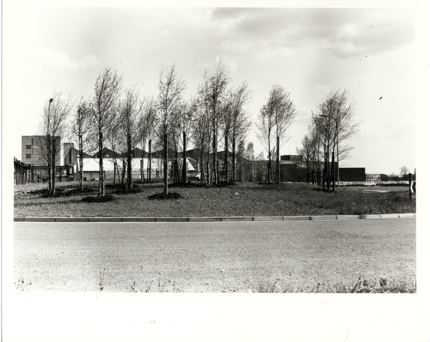
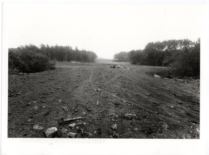
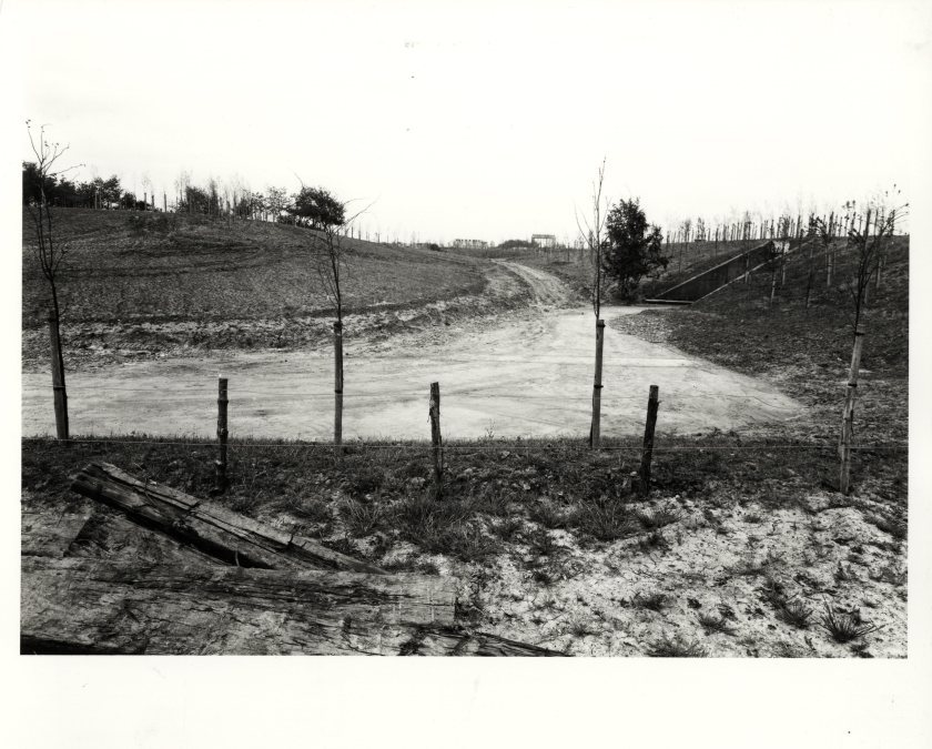
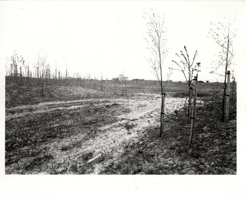
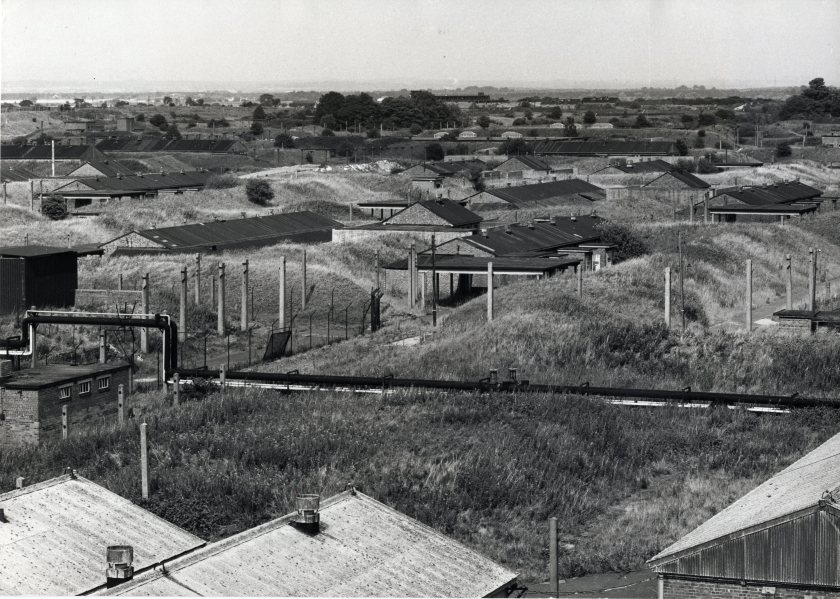
A page from the Birchwood Area District Plan (NTW 164/4) published by the Development Corporation in 1973. This photograph shows a derelict ‘Avenue’ within the vast ordnance factory complex.Chief Landscape Architect at the Development Corporation David Scott sent me this photo. He says: “This one shows the original ammunition storage bunkers prior to the demolition starting in 1975. This area now forms Birchwood District Park. Four of the bunkers were retained as features with their landform remodelled.” One of these bunkers was opened by the Development corporation as a museum about Birchwood’s wartime past. In what remains a highly controversial move, it was closed down and filled in shortly after the Development Corporation wound up its operations in 1989.(NTW 147) Aerial view of areas that would be become Birchwood Science Park, Heathfield and Locking Stumps . Note Chadwick House, the offices for the United Kingdon Atomic Energy Authority (UKAEA) to the upper right of the picture.Above: NTW 147_5_10. In The Buildings of England: Lancashire: Liverpool and the South West (2004), a series of books updating Nikolaus Pevsner’s eye- wateringly detailed survey of the nation’s architecture, the above building is fleetingly referred to: “Of this early, optimistic phase, the best building, designed by Chamberlain, Powell and Bon like a Modernist peripteral temple, has been demolished”. I have not yet located a date for this building, but those with good eyesight may be able to identify that this buiding appears on the aerial view picture above, in the centre of the ring road layout. It therefore pre-dates the construction of housing in Locking Stumps. Look out for some excellent shots of this building in the People’s Archive section in the photos of Nigel Hartley, a keen photographer living in Birchwood in the late 1970’s.NTW 147_5_33-3. A newly installed sign for the Birchwood exit of the M62 – with its wrappers still visible!Houses in and around Kinsale Drive with the M6 at the bottom left. The outline of Glover Road is visible in the upper section of the imageAbove: NTW 147_5_33_5. The location of this photograph within the archive (in a file named Grange Employment Area Vol 1) is the only indication as to where this image was taken. The lack of reference points in the landscape make for some stark and striking images.M6 motorway cutting through farmland. Possibly prior to the development of the surrounding area as the Grange Employment AreaAbove: NTW_147_5_33_2 This may be the exit off the M62 for Birchwood, where the mobile phone transmitter-cum-piece of public art called “Encounter” now standsAbove: NTW 147_5_76_1 This was filed in Locking Stumps 6 Rented Housing Vol 1. I am currently working on an assumption that the ‘6’ refers to the numerical system used by the Development Corporation to refer to the different ‘closes’, ‘walks’, ‘groves’ etc. that were subsequently given the names of flowers in Locking Stumps and birds in Oakwood. I am not 100% sure, but Locking Stumps 6 may refer to Heather Close. You can see how the road has been marked out around this tree for this particular close. Very much in the spirit of the ecological planning approach which sought to work very closely with the vegetation that was found on site.Above: NTW 147_5_76_4. Also from Locking Stumps 6 Rented Housing. Residents of Birchwood will probably recognise the cobble detail which remains a feature to this day of the road/ pavement demarcation in the Development Corporation designed housingAbove: NTW 147_5_76_3. From same file as previous images. The cobbles mark the entrance to the close. One interviewee-participant of this research who has been resident in Locking Stumps since the late seventies recalls an actual cattle grid at the entrance to her close in those early years.Above: NTW 147_5_77_1. Construction gets under way in Locking Stumps 6. Chadwick House in the background may help those of you familiar with the area get your bearings.Above: NTW 147_5_77_2. Only a small number of photos in the archive feature the context given in the typed caption.NTW 147_5_103_ 2 . File called Risley General. This looks like newly landscaped car parks in what is now called Birchwood ParkAbove: NTW 147_5_103_3. I think this is the main road running through Birchwood Park.Above: NTW 147_5_90_4. An intriguing glimpse at the area “Oakwood 13” prior to the roads and houses. See below
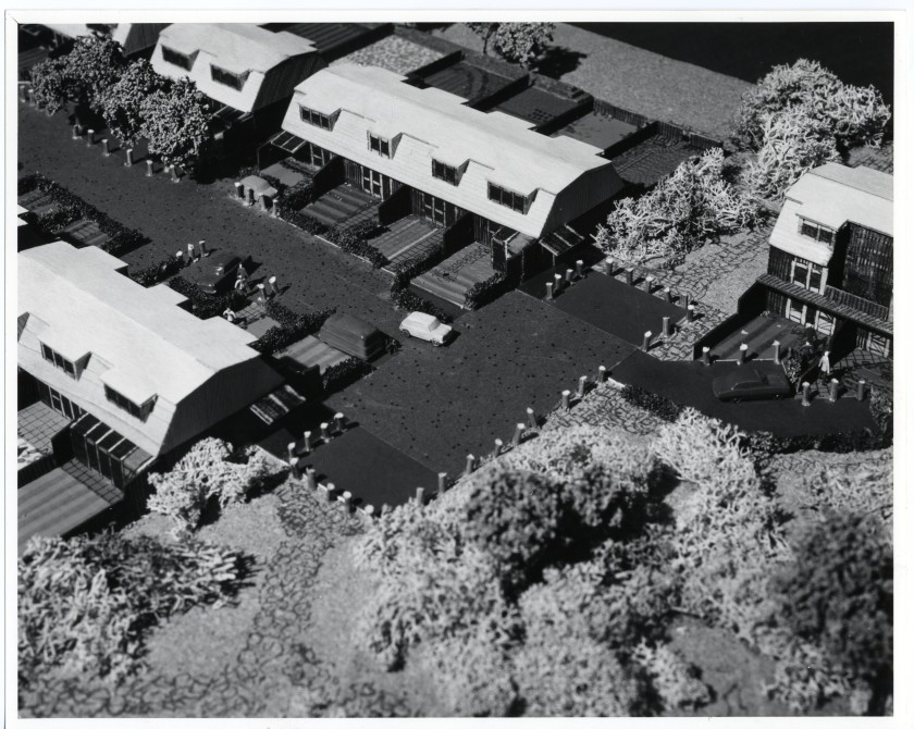
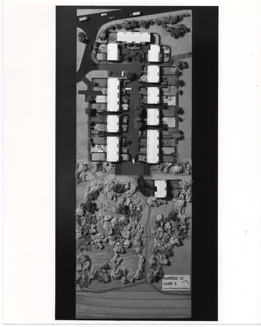
Above three images: NTW 147_5_90_(1,2,3). Architectural models by Farrell and Grimshaw Partnership for Oakwood 13, low cost timber framed housing. In The Buildings of England, Lancashire: Liverpool and the South West these buildings and their setting in Oakwood are described: Four Parallel lanes are carefully and charmingly extended amongst trees, petering out into woodland to the south. The lanes are lushly leafy and intimate – without separate pavements after the Woonerf concept – and seem to capture the intimacy and friendliness of idealised village lanes. Farrell’s intention to make them communal spaces inhabited by all , not public spaces shunned by all, appears to have been realised. (Richard Pollard and Nikolaus Pevsner Yale University Press 2004)
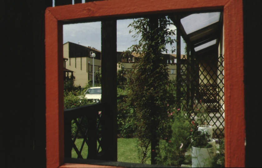
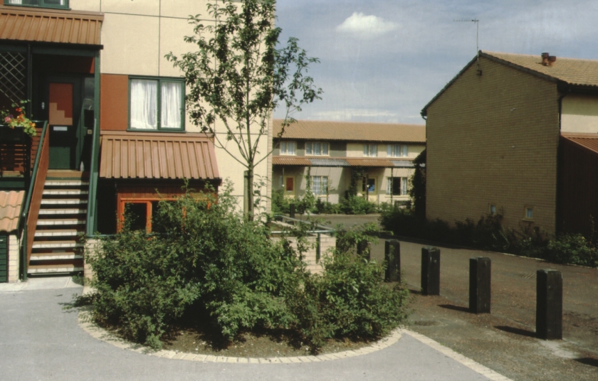
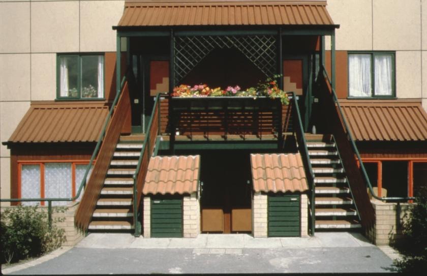
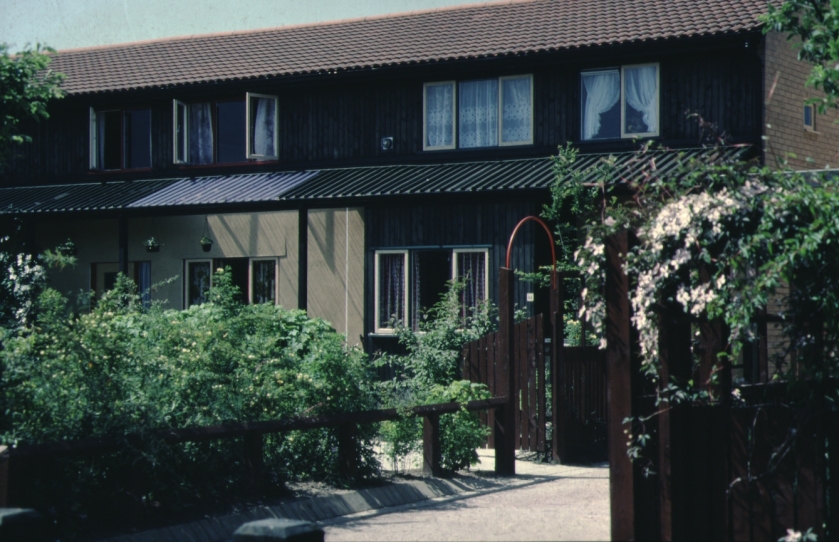
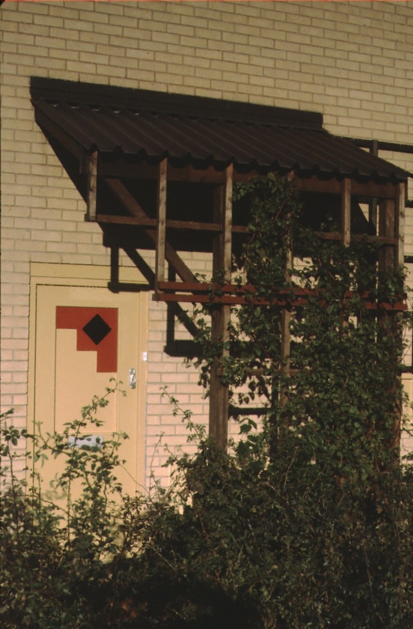
above four images: no NTW reference. From slides collection. Oakwood 13 rented housing realised.Above: detail from Oakwood 13 rented housing
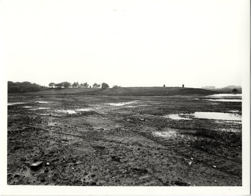
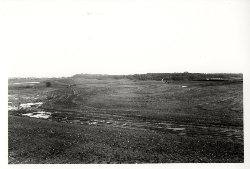
NTW 147_5_7_1. Early landscaping at Birchwood District Park, later known as Birchwood Forest Park with one of the Ordnance Factory bunkers visibleNTW 147_5_7_2 Birchwood Forest Park with the UKAEA research reactor in backgroundNTW 147_5_7_3. Chief Landscape Architect for the Development Corporation David Scott sent a very similar photo to this one of landforms being created (from the rubble of the Ordnance Factory) for Birchwood Forest Park.
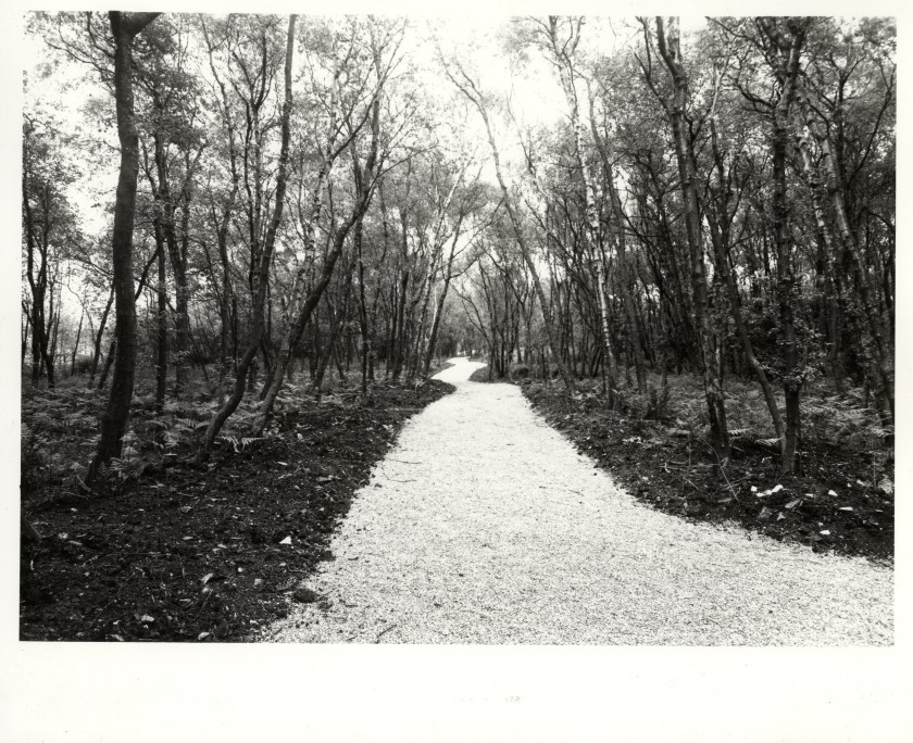
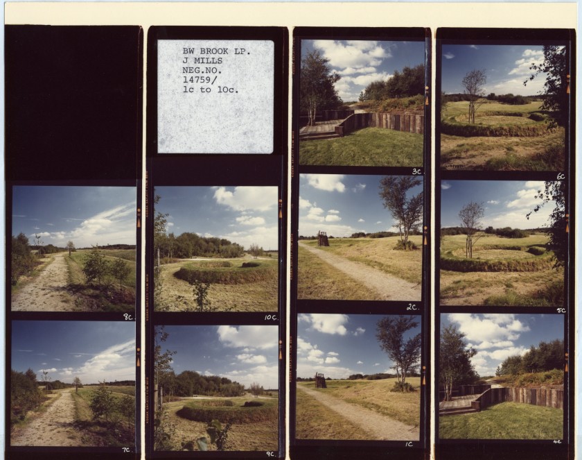
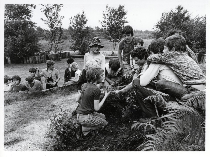
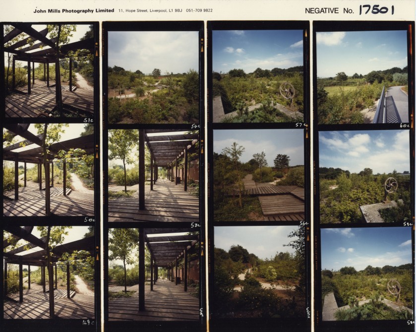
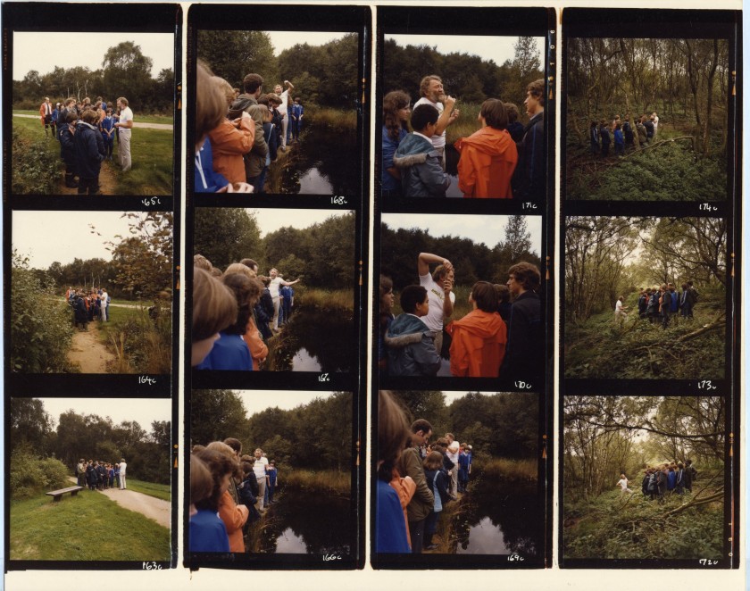
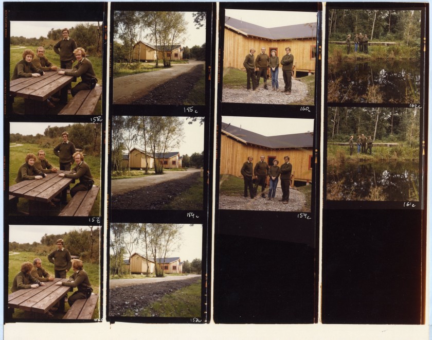
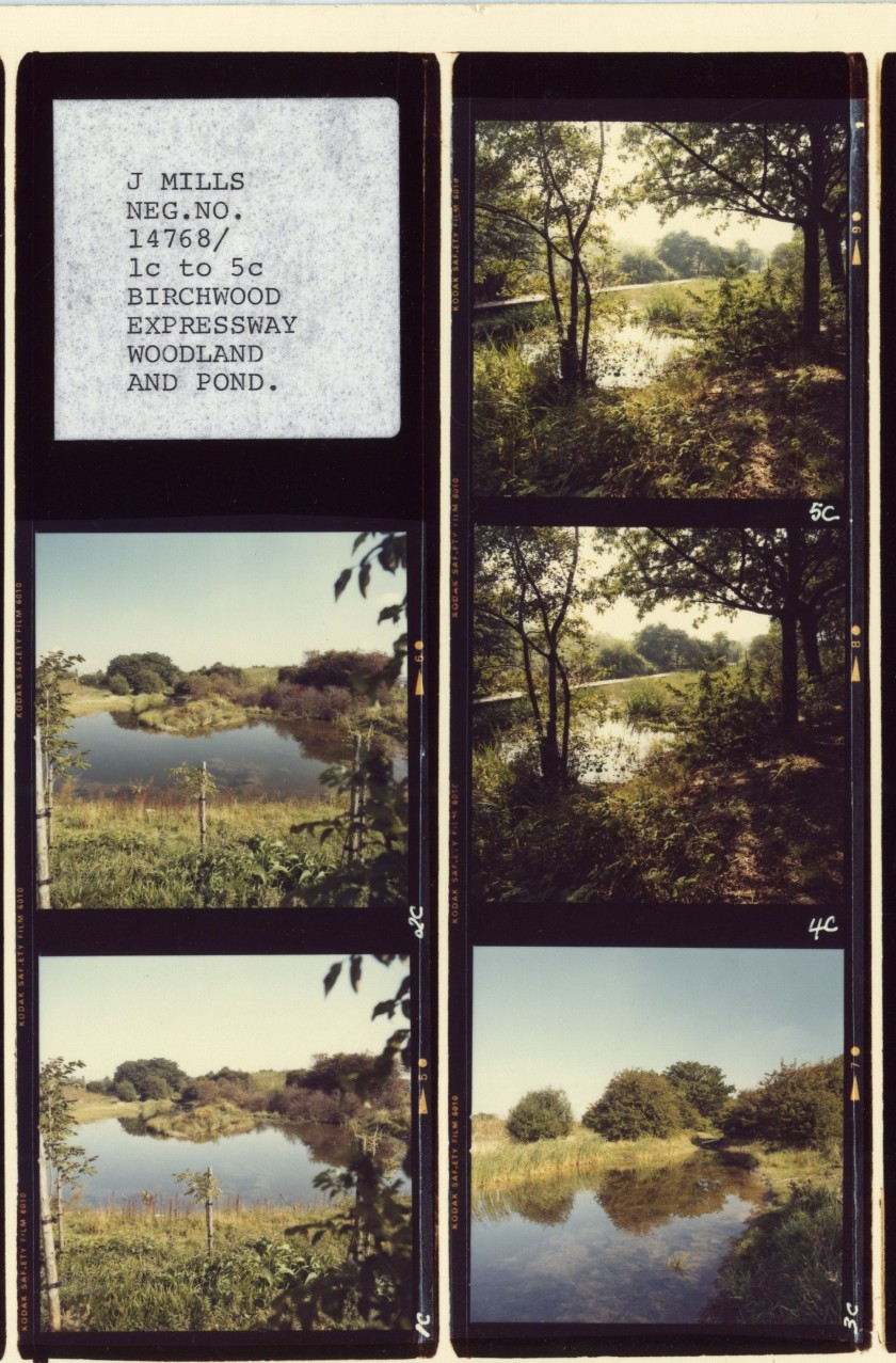
Above: NTW 147_5_7_(4&5). Birchwood Forest park landforms and landscapingNTW 147_5_27 Contact sheet of newly completed Birchwood Brook Linear Park. Many of the professional shots of the finished areas were taken by J Mills Photography based on Hope Street, Liverpool.NTW 147_5_5_1. Rangers with groups of young Birchwood residents at Birchwood Brook Linear Park. Warrington New Town had the UK’s first Ranger Service. Their remit was in large part about working with the new communities to foster a sense of ownership of the landscape. There was a strong emphasis on the educational potential of the ecological planning approach taken by the design team at the Development Corporation. One Ranger who has been interviewed for this research says: In the New Town days when I started at Forest Park there were actually seven rangers there, doing all this work with schools particularly. We were in schools all the time, we would just walk into a school or a teacher would ring up and say can we do a group with you this afternoon?
Landscaping at Birchwood Brook
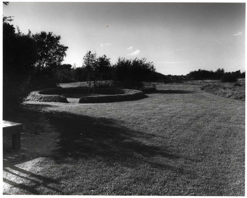
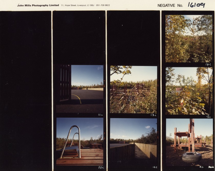
Above: two contact sheets within NTW 147_5_27. The Walled Gardens. The reservoir for the Ordnance factory was re-purposed as an impressive and elaborate garden through which residents of Locking Stumps could meander on their way to the Birchwood Centre! At present, having been somewhat abandoned for many years, the community group Friends of the Walled Gardens hope to reverse the decline of the site.Above: One of the many play areas around Birchwood designed by Development Corporation Landscape Architect Robert Tregay.
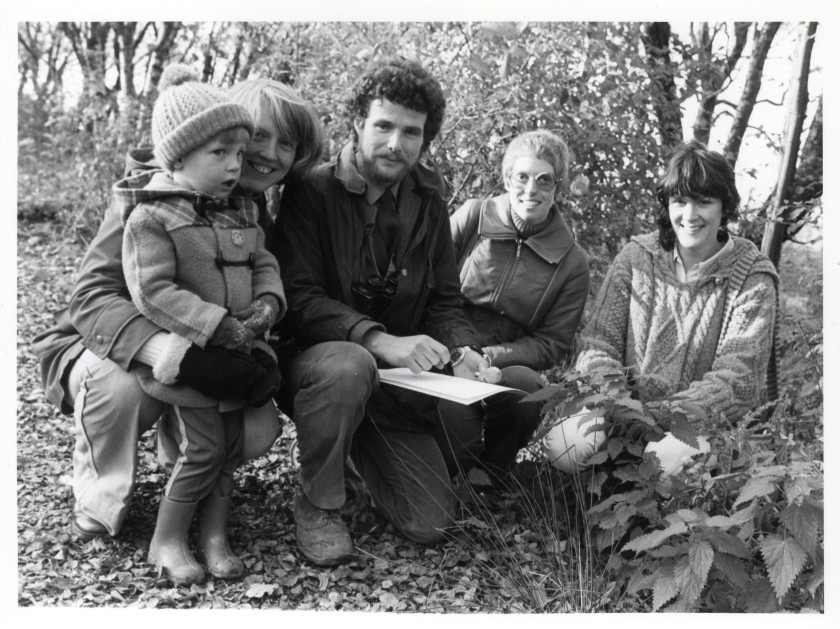
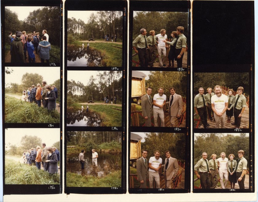
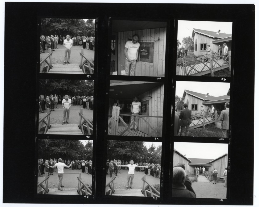
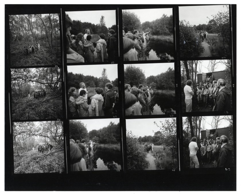
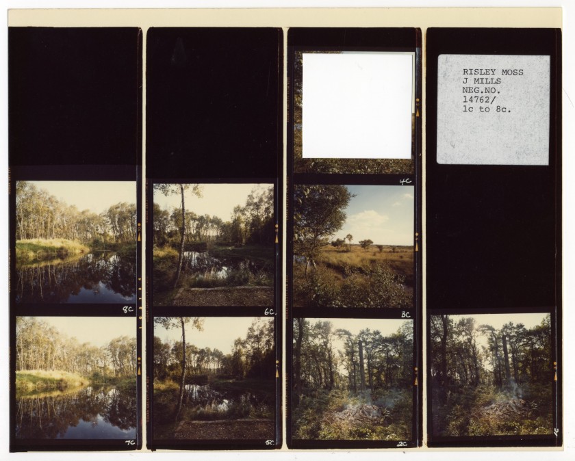
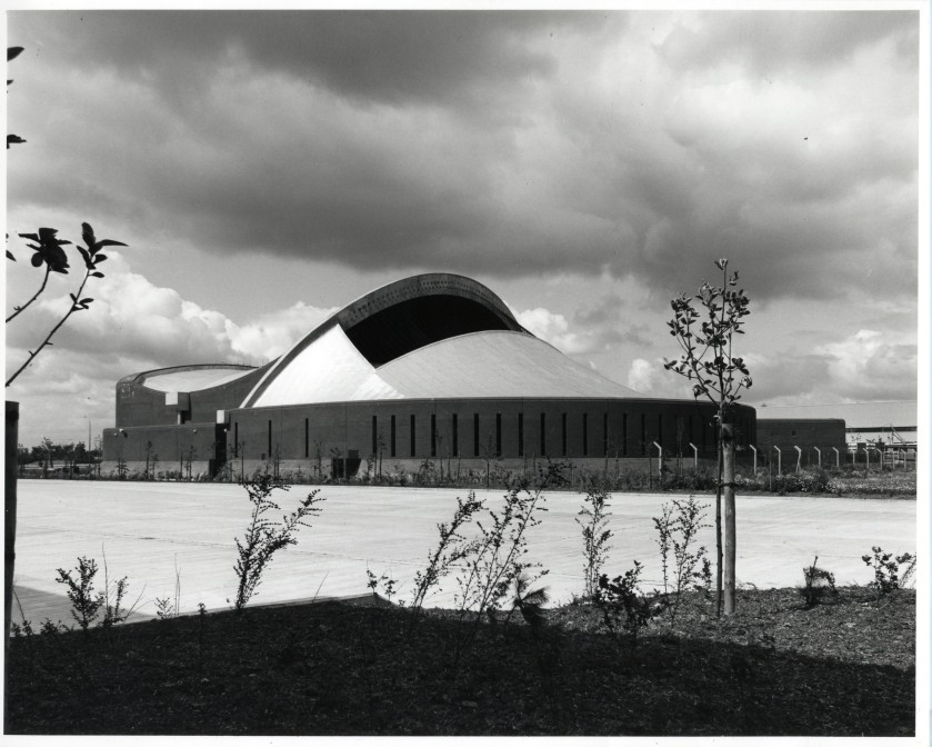
Above: NTW 147_5_27. Professor David Bellamy opens Risley Moss in 1980. He was a familiar face on the TV screens in the 1970’s and 80’s and his figure still adorns a wall within the Risley Moss Visitor Centre to this day. Members of RIMAG, (Risley Moss Action Group) called upon him a second time to speak in favour of Risley Moss when in 1990 Cheshire County Council proposed closing the site down.NTW 147_5_27. Some of the Rangers at Risley Moss Nature Reserve. As previously mentioned, Warrington New Town appointed the UK’s first Ranger Service. Hugh Cannings, Chief Architect and Planner at the Development Corp in the 1970’s into the early 1980’s had spent some time in the US where he saw how Park Rangers services were deployed in urban green spaces. Current Birchwood Park Ranger Gaynor Kerry has helpfully supplied some names for the faces: Sue Curry, Chas Purvis, Dave Foster and Ken Watt. Also in this contact sheet is the Visitor Centre designed by the Building Design Partnership 1980.Above: from same file as previous images. Promotional images (slightly damaged). Alongside the illustrations of residential areas (see below) the images designed to promote Birchwood to potential residents, who may come to the area with young families, reflect a pristine landscape of newly planted areas and brand new play areas, suggesting a sort of utopian ideal of living in nature!
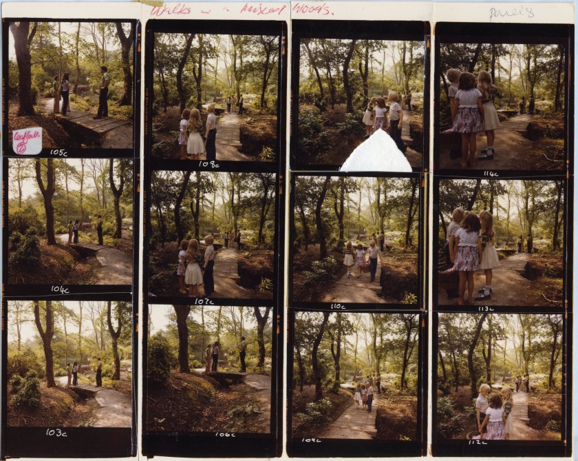
Above two images: David Bellamy officially opens the Visitor Centre at Risley Moss and leads a tour of the nature reserve for some young residents
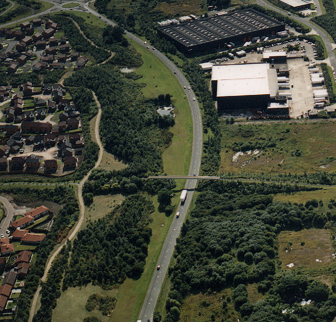
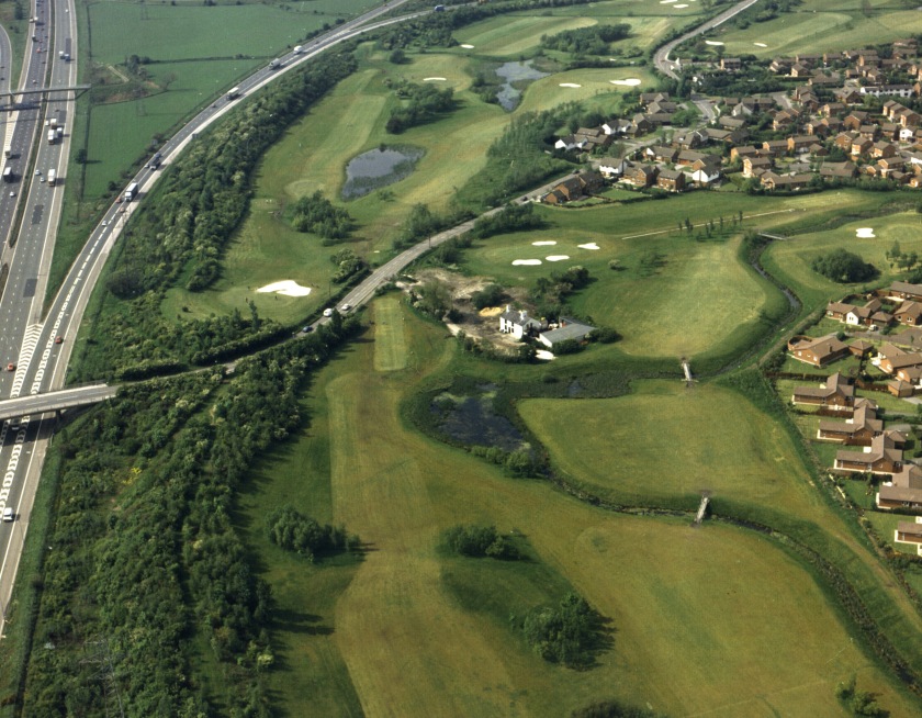
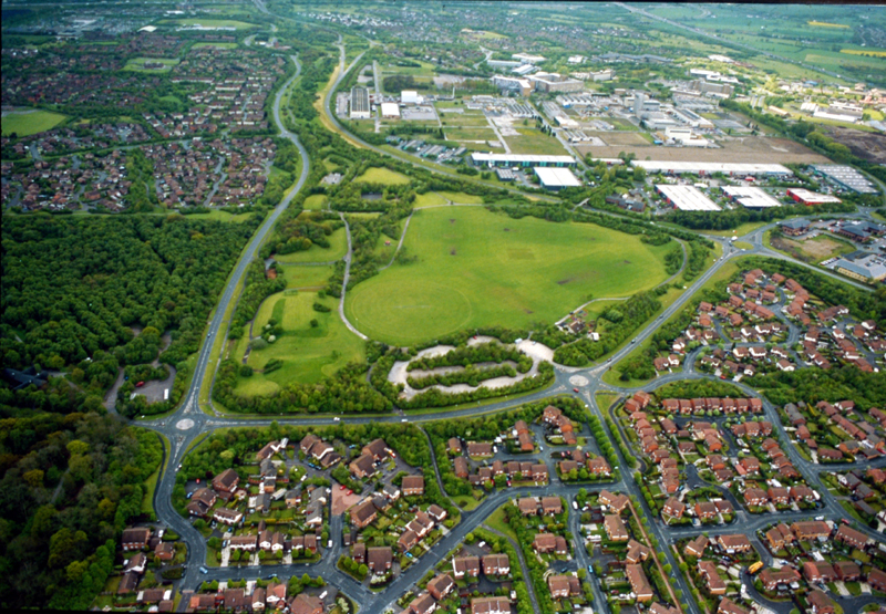
Above three contact sheets: Landscaping along Birchwood Expressway. These green corridors were designed by Chief Landscape Architect at the Development Corporation David Scott and his team. He has kindly supplied some aerial views of these corridors. See below:
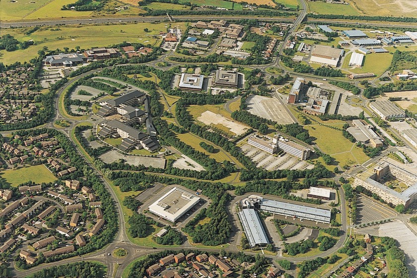
Above: Sent from David Scott. Aerial view of Birchwood Expressway linking the M62 to Birchwood. With Gorse Covert to the left, part of “Risley Employment Area” as it was referred to in the archive on the right.Above: From David Scott. Aerial view of Birchwood Golf Course, Locking Stumps Lane cutting through and the M6 on the leftAbove: the buildings of Birchwood Park with the houses of Locking Stumps to the left and the M62 at the top of the image. Visible here are some innovative buildings including on the left half of the image, with the dark roof tiered wings, British Nuclear Fuel’s Hinton House, designed by DEGW Architects, opened in 1984.
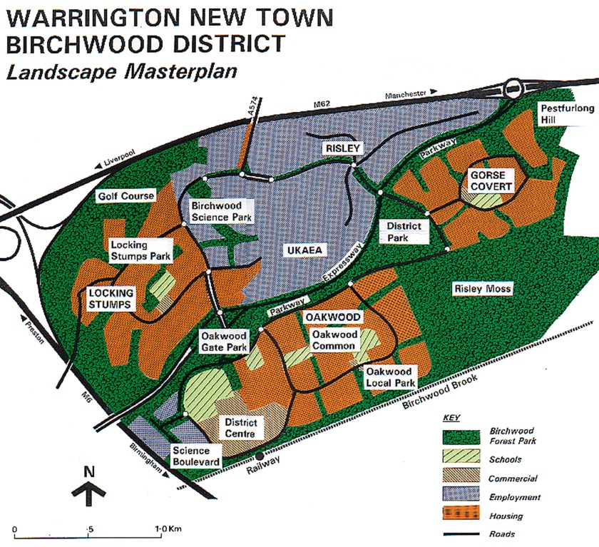
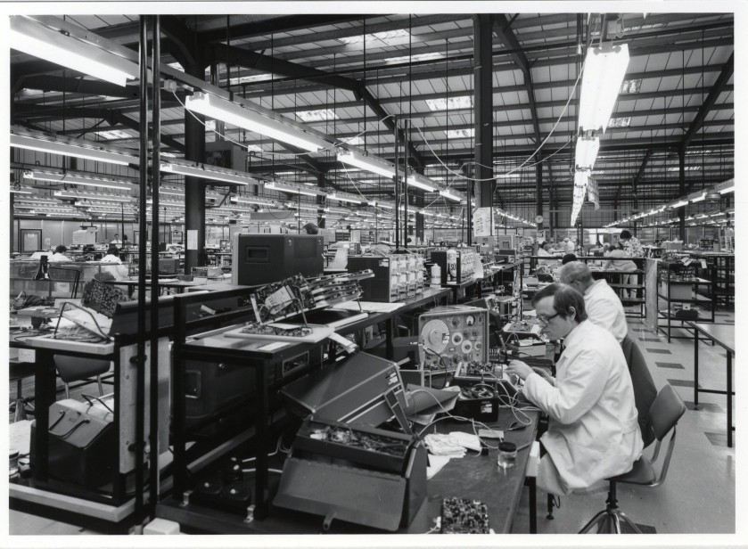
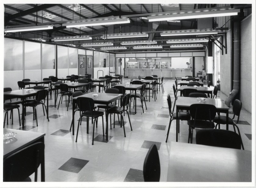
Image donated by David Scott showing the masterplanning for the landscape of Birchwood and aerial photograph taking in some of Gorse Covert, Oakwood, the Forest Park, and the UKAEA siteAbove: NTW 147_5_32_1 Barclays Bank Paper and Metal Store, Kingsland Grange. Designed by Barclay’s architect Don Collins with structural engineers White, Young and Partners 1979.Above: NTW 147_5_32_2 Racal Communications interior, Woolston Grange April 1976Above: NTW 147_5_32_3 Racal Communications staff canteen, Woolston Grange, April 1976
 Above: a page from Robert Tregay and Roland Gustavsson’s Oakwood’s New Landscape: Designing for nature in a residential environment (NTW 68/19. Published jointly by WNTDC and Sveriges Lantbruksuniversitet 1983). Tregay was part of the landscape architects team at the Development Corporation which was led by David Scott. Here we see an aerial view prior to the ordnance factory being cleared. To give those familiar with Birchwood a sense of the scale of the site visible here: you are looking at the areas that would become Oakwood, Gorse Covert and Birchwood Forest Park. To the bottom right of the picture is the Liverpool to Manchester railway line. The darker vegetation visible towards the upper right of the picture is the moss that was preserved and opened as a nature reserve, Risley Moss in 1980.